
Huangshan hiking guide
Plan the mountain by hours of steps, not by distance alone
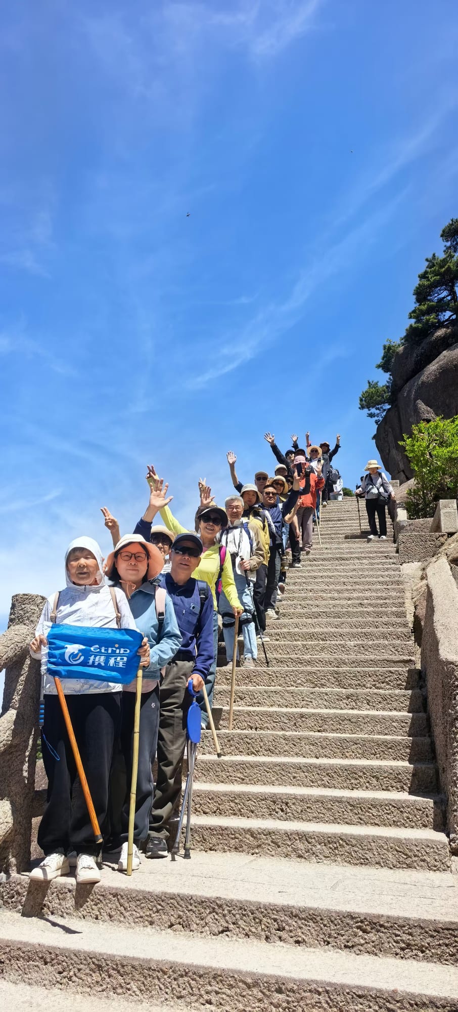
Huangshan routes are built around stone stairways, cableways, viewpoints, hotels, and weather-dependent sections. A realistic plan starts with the slowest traveller and a confirmed exit time.
Quick answer
Cableways reduce the ascent, but they do not remove mountain walking
Even a cableway-based visit involves station transfers, queues, stairs, uneven stone, and walking between viewpoints or hotels. A longer hiking route adds sustained ascent and descent, so the same itinerary can feel very different in rain, cold, crowds, or low visibility.
Cableway-based route
Best for travellers prioritising selected viewpoints and a controlled amount of walking.
Extended summit route
Requires more continuous steps, a clear hotel or exit plan, and enough time margin.
Long stair ascent or canyon section
Only suitable when fitness, daylight, open sections, weather, and return logistics align.
Route decisions
Match the entrance, cableway, hotel, and exit
| Decision | What changes the answer |
|---|---|
| Eastern or Western Steps | Open entrances, route direction, cableway use, hotel position, fitness, weather, and whether the journey is one-way. |
| West Sea Grand Canyon | Seasonal access, open sections, funicular operations, crowds, and the time needed to reach the next hotel or cableway. |
| Overnight or day trip | Sunrise interest, room availability, luggage, budget, weather tolerance, and the next transport connection. |
| Footwear | Route length, wet or icy conditions, grip, ankle support, and whether the shoes are already broken in. |
Porter-carried chairs
Selected sections and company-provided maximum-price references
These services cover specific sections rather than the whole mountain. Availability is not guaranteed. Confirm the exact operating section, passenger suitability, and final price before accepting the service.
Front-mountain sections
| Section | Distance | Reference maximum per chair |
|---|---|---|
| Tianhai to the top of Aoyu Peak | 1 km | RMB 100 |
| Top of Aoyu Peak to the bottom of Lotus Valley | 0.75 km | RMB 180 |
| Bottom of Lotus Valley to Lotus Pavilion | 0.5 km | RMB 100 |
| Lotus Pavilion to Yupinglou | 1.25 km | RMB 150 |
| Yuping Cableway upper station to Yupinglou | 0.75 km | RMB 100 |
| Yuping Cableway upper station to Lotus Pavilion | 1.25 km | RMB 150 |
Back-mountain sections
| Section | Distance | Reference maximum per chair |
|---|---|---|
| Bai'e Ridge to Beihai | 1 km | RMB 130 |
| Bai'e Ridge to Beginning-to-Believe Peak and Beihai | 1.5 km | RMB 180 |
| Bai'e Ridge to Beihai and Xihai | 2 km | RMB 270 |
| Bai'e Ridge to Beginning-to-Believe Peak, Beihai and Xihai | 2.5 km | RMB 320 |
| Bai'e Ridge to Beginning-to-Believe Peak, Lion Peak and Xihai | 3 km | RMB 400 |
| Bai'e Ridge to Beihai, Xihai and Paiyun Pavilion | 2.75 km | RMB 360 |
| Bai'e Ridge to 701 Television Tower and Bright Summit | 2 km | RMB 450 |
| Bai'e Ridge to Bright Summit | 2.5 km | RMB 540 |
| Bai'e Ridge to Bright Summit, Xihai and Beihai | 6.75 km | RMB 630 |
| Beihai to Beginning-to-Believe Peak and back to Beihai | 1.5 km | RMB 300 |
| Beihai to 701 Television Tower and Bright Summit | 3 km | RMB 450 |
| Beihai to Xihai and Bright Summit | 4.75 km | RMB 540 |
| Beihai to Bright Summit, Flying-over Rock and back to Beihai | 7.75 km | RMB 630 |
| Beihai to Xihai | 1 km | RMB 180 |
| Beihai to Xihai and Taiping Cableway | 2.25 km | RMB 320 |
| Beihai to 701 Television Tower, Bright Summit and Tianhai | 3.5 km | RMB 540 |
| Beihai to Xihai, Bright Summit and Tianhai | 5.25 km | RMB 630 |
| Xihai to Flying-over Rock | 2.25 km | RMB 320 |
| Xihai to Bright Summit, Flying-over Rock and back to Xihai | 7.75 km | RMB 630 |
| Xihai to Flying-over Rock and back to Xihai | 4.5 km | RMB 500 |
| Xihai to Flying-over Rock and Bright Summit | 3.75 km | RMB 450 |
| Xihai to Flying-over Rock, Bright Summit and Tianhai | 4.25 km | RMB 540 |
| Xihai to Lion Peak and back to Xihai | 3 km | RMB 360 |
| Xihai to Lion Peak, Beginning-to-Believe Peak and back to Xihai | 4.5 km | RMB 580 |
| Xihai to Paiyun Pavilion and the second cableway | 1.25 km | RMB 100 |
Overnight packing
Take a small mountain bag and store the main suitcase
- Layered clothing and a waterproof outer layer
- Supportive shoes with reliable grip
- Essential medication, passport, and booking details
- Power bank, sun protection, water, and modest snacks
- Only the toiletries and personal items needed overnight
- A confirmed plan for luggage left at the hotel, station, or mountain base
Questions travellers ask
Hiking and physical-planning questions
Use these answers alongside the detailed guidance above. Recheck time-sensitive information before travel.
01 How difficult is hiking Huangshan?
Huangshan is demanding because much of the route uses steep stone steps rather than level hiking trails. A cableway can remove a long ascent or descent, but visitors should still expect sustained walking, stairs, uneven surfaces, and changing weather. Difficulty depends on the gate, cableway, hotel, open trail sections, and whether the route includes the West Sea Grand Canyon.
02 Should I use the Eastern Steps or Western Steps on Huangshan?
The Eastern Steps are commonly chosen for a more direct ascent, while the Western Steps are longer and generally more strenuous. The better choice depends on open entrances, the cableway plan, hotel, weather, and whether the route is one-way or a return journey. Confirm current trail access before committing to either route.
03 How long does the West Sea Grand Canyon take?
Allow several hours rather than treating it as a short viewpoint stop. Time varies substantially with the entrance, open sections, crowd levels, fitness, rest stops, and use of the sightseeing funicular. The canyon may close seasonally or during unsafe weather, so confirm access on the day and leave enough time to reach the hotel or cableway.
04 What should I pack for an overnight stay on Huangshan?
Take a small bag with layered clothing, a waterproof outer layer, shoes with reliable grip, essential medication, a power bank, passport, booking details, and only the toiletries you need. Add sun protection and enough water or snacks for the route. Mountain temperatures can be much lower than in Huangshan City.
05 Is it safe to hike Huangshan in winter or rain?
It can be possible, but wet stone, ice, strong wind, low visibility, lightning, and temporary trail or cableway closures require conservative planning. Follow official notices, use suitable footwear, avoid closed or undeveloped areas, and be prepared to shorten or cancel exposed sections.
06 Do I need hiking boots, or are trainers enough for Huangshan?
Supportive walking or hiking shoes with good grip are the safest general choice. Athletic trainers may be adequate for a shorter cableway-based route in dry conditions, but smooth-soled fashion shoes are unsuitable for long stone steps or wet weather. Break in new footwear before the trip.
07 Are porter-carried chairs available on Huangshan?
Porter-carried chairs are available on selected front-mountain and back-mountain sections. They are generally carried by two porters and can help on a specific stair section, but they are not guaranteed on demand and cannot cover every trail. Confirm the route, availability, and final price before accepting the service; do not use it as the only plan for serious mobility limitations.
08 How many steps are there on Huangshan?
There is no useful single official step count for a Huangshan visit. The scenic area contains many routes, entrances, cableway combinations, detours, and temporarily closed sections. Plan around walking time, elevation change, cableway use, and the traveller's ability rather than an internet estimate of total steps.
Review and sources
Check live details before making fixed bookings
Last reviewed:
Trail access, canyon sections, cableways, porter availability, and safety controls can change with weather, maintenance, and crowd management. Porter routes and reference maximum prices above are company-provided information authorised for publication.
Start a conversation
Choose a route that the whole group can finish safely.
Share the ages, walking ability, preferred hotel, mountain day count, luggage, and onward connection if you need help comparing a cableway-based visit with a longer hike.